
Description
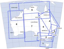
The ERC (L) are drawn to various scales to accommodate significant air traffic route areas and show controlled airspace, prohibited, restricted and danger areas, air routes, ATS and radio-navigation services.
The ERC (L) are drawn to various scales to accommodate significant air traffic route areas and show controlled airspace, prohibited, restricted and danger areas, air routes, ATS and radio-navigation services.